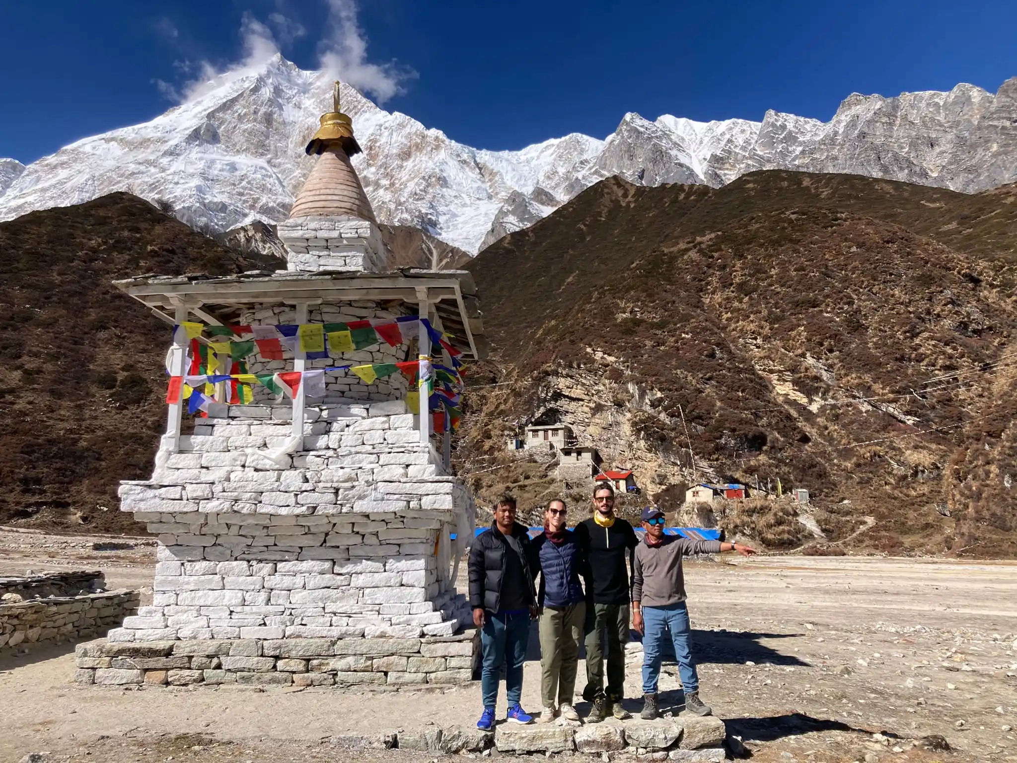
Manaslu trek is one of the most famous and accessible trekking in Nepal. The route develops around Mount Manaslu (8163m) and leads up to 5134m of the Larke Pass in one of the most beautiful mountain settings of the Himalayan region.
Despite its beauty, the vast majority of trekkers in Nepal (~90%) are currently trekking the Annapurna circuit or the Everest, making the Manaslu circuit still an off-the-beaten-path experience despite its increasing popularity.
Indeed, we found this trek because we wanted to avoid the big crowds but on the other hand we did not want to spend a fortune on a more remote place like the Dolpo region (a dream kept for another trip). The starting of the trek can be accessed via road without the need to take a flight and the permits are not so expensive (around 100$ per person a week).
It is named by many guides the most beautiful trekking in Nepal (for example: Rough guide, which we used in Nepal).
This is also why Sofia and I decided to trek the Manaslu circuit in November 2023. We were not disappointed: the trekking was stunning from beginning to end and in many sections of it we were simply breathless for the beauty of the landscape.
In this short guide, we will give you a brief overview of the trek and our opinion about it.
Key facts
- Elevation Gain: >11000m
- Total length: 165km - Can be shortened slightly as of 2024, given that they are pushing the construction of the road further and further to connect Nepal to Tibet.
- Terrain: Some dirty road at the beginning and the end, mountain trail the vast majority of it.
- Difficulty: There is no technical difficulty, but you need to be able to walk several hours a day with sometimes more than 1000m elevation. Your fitness level should be adequate for this. You don’t need to be crazy sporty to do it but be willing to endure long walks and the cold. If you are comfortable with that, you should not have any problem.
- Days required: Between 12 and 14 days.
- Permits: You will need both Manaslu and Annapurna area permits, however, if you hike with an agency they will take care of them for you.
- Guide: They are mandatory in this region, and you can either go with an independent guide or with an agency. We were skeptical about hiking with a guide, however, we completely changed our mind after the trip. A good guide like ours (Amar from Outfitter Nepal) will enrich your journey, teach you new things, and make your trip memorable.
- Accommodations: You don’t need a tent, you can always sleep in teahouses. Do not expect the grand hotel but they are generally good and we always had a private room, which is nice. Going up in altitude the comfort decreases as it should: shared bathrooms (sometimes we shared it with around 10 people), cold showers (almost until the top you could buy warm water for the shower), and, most of all, cold temperatures, rooms are not heated and not well isolated. This can also be positive overall, because it forces everyone in the only heated room and that is how we met fellow trekkers from all over the world while playing cards and chatting.
What made Manaslu Circuit so special for us
- The Himalayan beauty: it is needless to say trekking in the Himalayas is a lifetime experience.
- The trek starts at 500m and goes up to 5134m at Larke Pass. This gives you the rare opportunity to experience how the landscape changes at different elevations in only two weeks. There are not many commercial treks around the world that allow that. Moreover, this impacts your acclimatization training: starting so low in altitude gives you plenty of time to acclimatize and enjoy the beauty without feeling sick.
- The opportunity to experience two cultures: Nepalese and Hinduism at lower altitudes and Tibetan and Buddhist at higher ones. This is one of the few areas in Nepal completely inhabited by Tibetan people.
- The possibility to experience two different valleys with different landscapes: Manaslu valley before Larke pass, and Annapurna valley after the pass for the last days.
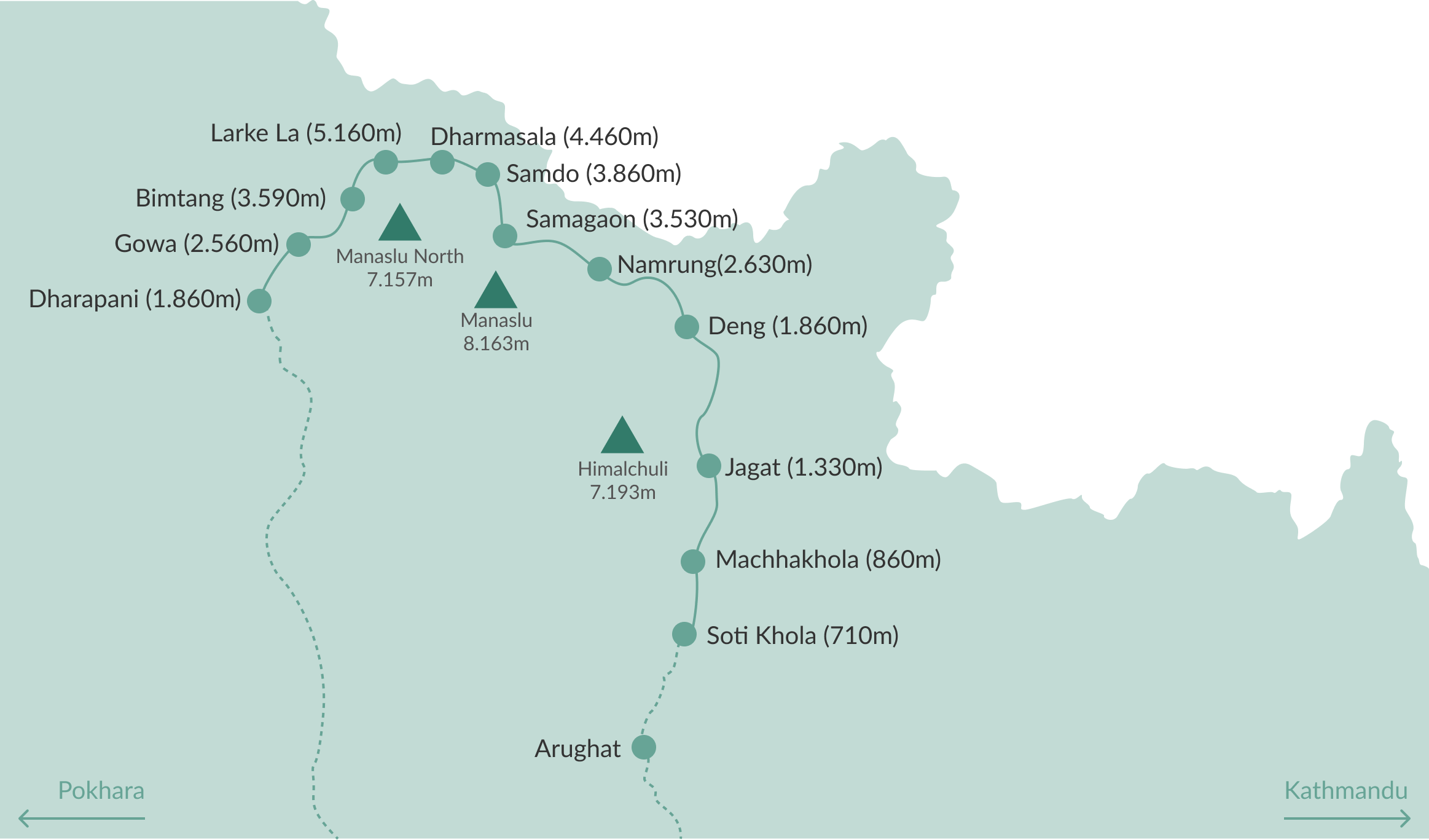
Our Trip in a Nutshell
- Day 0: Bus from Kathmandu to SothiKhola
- Day 1: Trek from SothiKola (710m) to Machakola (860m). Distance: 14km, Elevation gain: 500m
- Day 2: Trek from Machhakhola (860m) to Jagat (1.330m). Distance: 19km, Elevation gain: 1.300m
- Day 3: Trek from Jagat (1.330m) to Deng (1.860m). Distance: 20km, Elevation gain: 1.236m
- Day 4: Trek from Deng (1.860m) to Namrung (2.630m). Distance: 17km, Elevation gain: 1.200m
- Day 5: Trek from Namrung (2.630m) to Samagaon (3.530m). Distance: 10km, Elevation gain: 660m
- Day 6: Acclimatisation day. Day trip to Pungen Gumba (4.200m). Distance: 17km, Elevation gain: 800m
- Day 7: Trek from Samagaon (3.530m) to Samdo (3.860m). Distance: 9km, Elevation gain: 600m
- Day 8: Acclimatisation day. Day trip around Samdo (up to 4.800m)
- Day 9: Trek from Samdo (3.860m) to Dharma Shala (4.460m). Distance: 7km, Elevation gain: 700m
- Day 10: Trek from Dharma Shala (4.460m) to Bhimtang (3.590m) via Larke Pass (5.160m). Distance: 18km, Elevation gain: 800m
- Day 11: Trek from Bhimtang (3.590m) to Gowa (2.560m). Distance: 25km
- Day 12: Trek from Gowa to Tilche and jeep from Tilche to Daraphani
- Day 13: Bus from Daraphani to Kathmandu or Pokhara (we drove to Pockhara)
Day-by-day Review
Day 0: Bus ride from Kathmandu to SothiKola
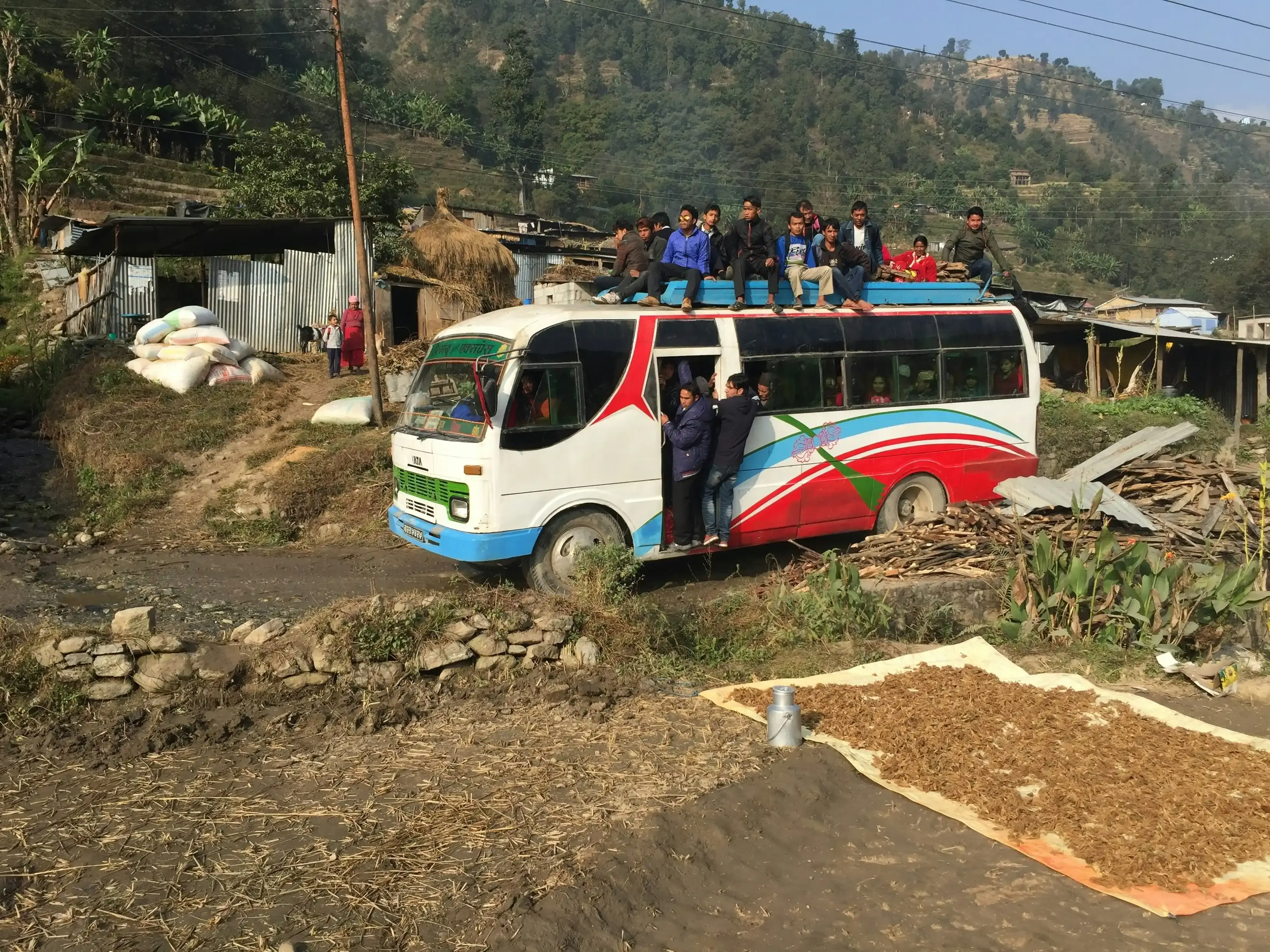
Early in the morning, our guide came to pick us up directly at the hotel and together we went to the bus station. We decided to take local transportation to save some money on the trip and to experience a real Nepalese local bus. We were told that the bus ride would have taken the whole day, and we were very skeptical at the beginning given the short distance to be covered: only 130 km. 10 hours later It turned out to be 130 km full of dust, mud, hole pots, and scary roads jam-packed with dozens of locals. It was funny, with a stunning view around, however not very comfortable. In the last section of the bus, some people jumped on the roof because there was no space anymore: it was the first time we experienced that. We were crazy excited to start and happy to arrive at our destination.
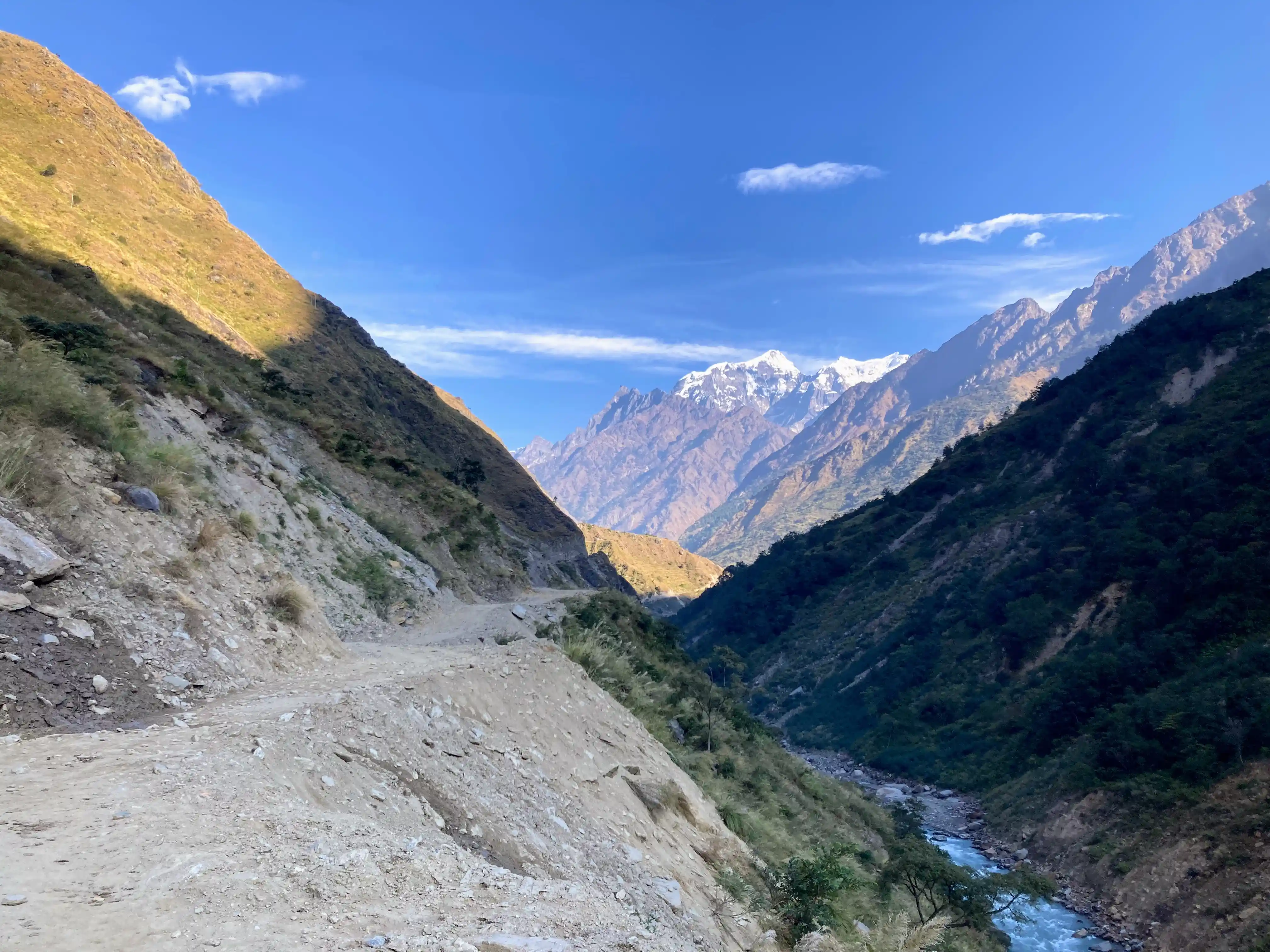
Day 1: Trekking from SothiKola to Machakola
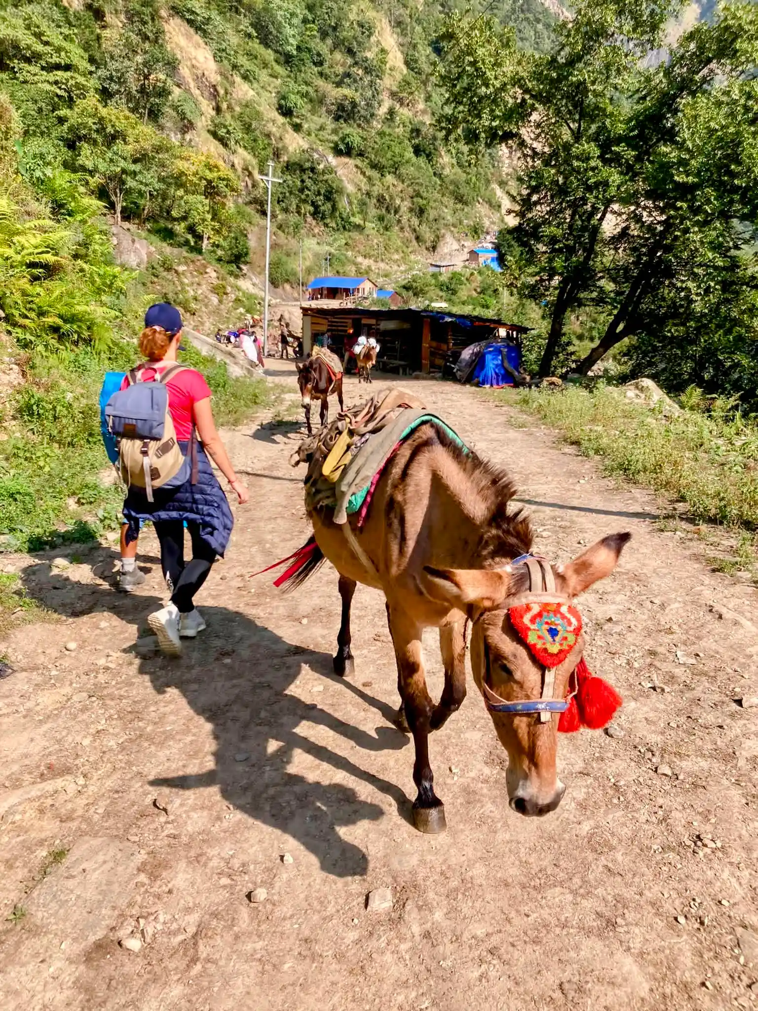
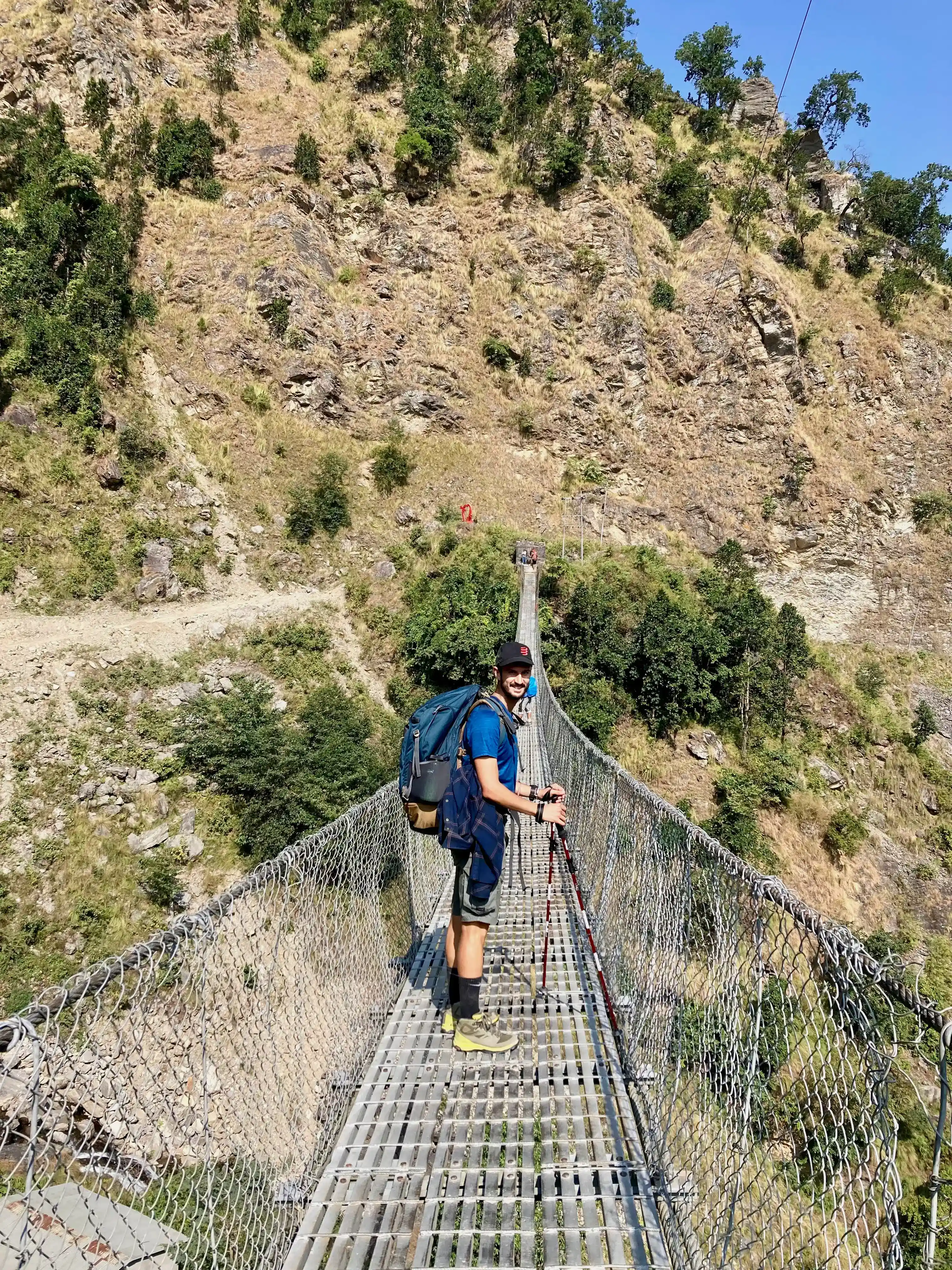
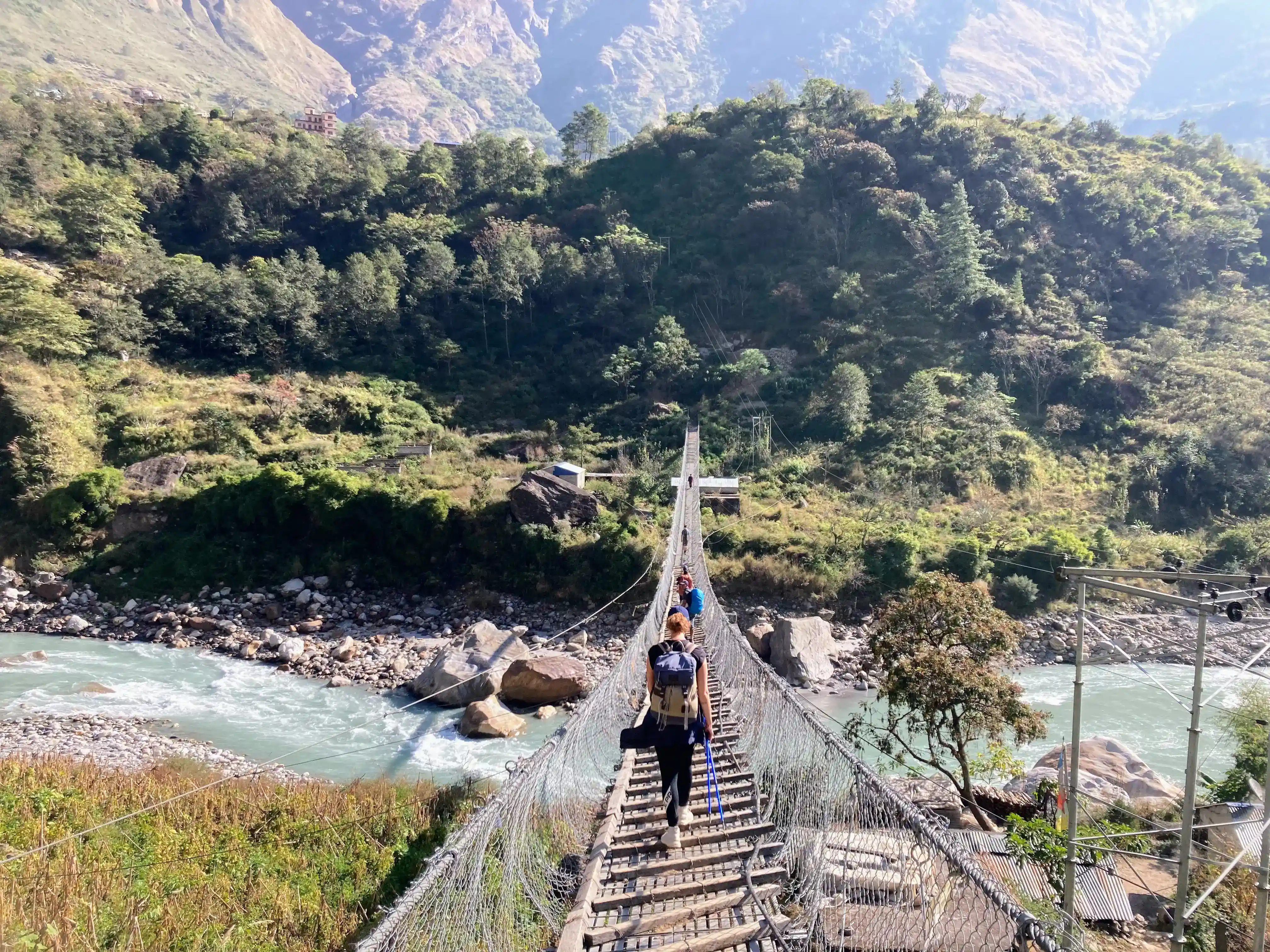
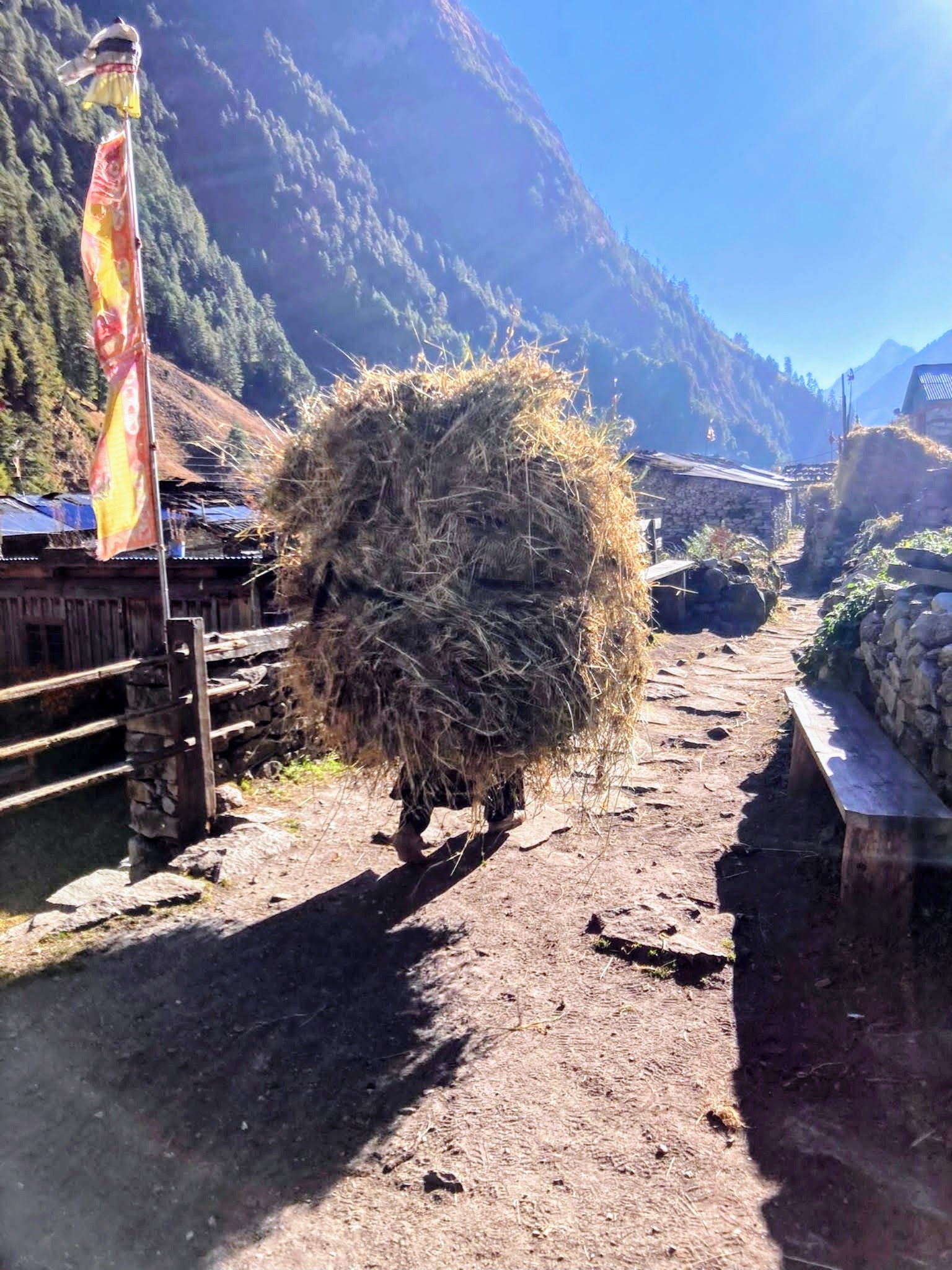
The first part of the trek is on a dirty road on which which only a few buses and a bunch of jeeps pass through. Thick vegetation and rice terraces are filling the landscape. We get through the first Tibetan bridges, and we see some locals beating the rice cropped to be the rice grains. October is the rice cropping season here.
The trek is not hard at all on the first day.
Day 2: Trekking from Machakhola to Jagat
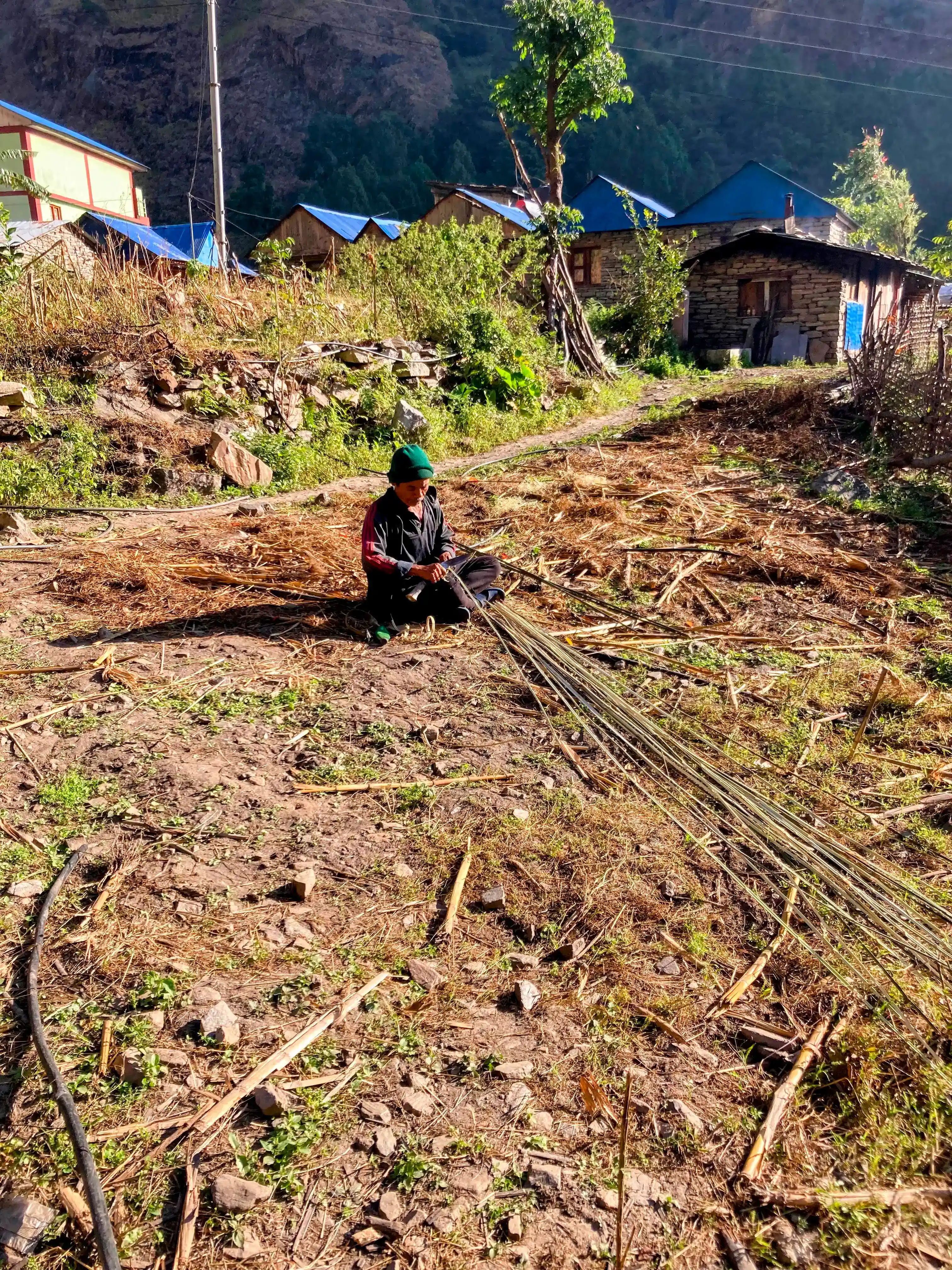
Today the trek is more intense. The day rhythm of the few people we met around is fully dominated by nature, as it could have been everywhere a century ago. Faces and places start getting wilder. We arrive at what we can consider the first mountain village of the trek: Jagat.
Day 3: Trekking from Jagat to Deng
Long trek, quite tiring. The legs are still unused to walking all day with a big backpack. There are a lot of ups and downs and a lot of Tibetan bridges. Deng is not a town, but rather a cluster of tea houses with a big lobby where trekkers have meals. Here we socialize with other fellow trekkers and guides. We learned how to play Dumbal.
Day 4: Trekking from Deng to Namrung
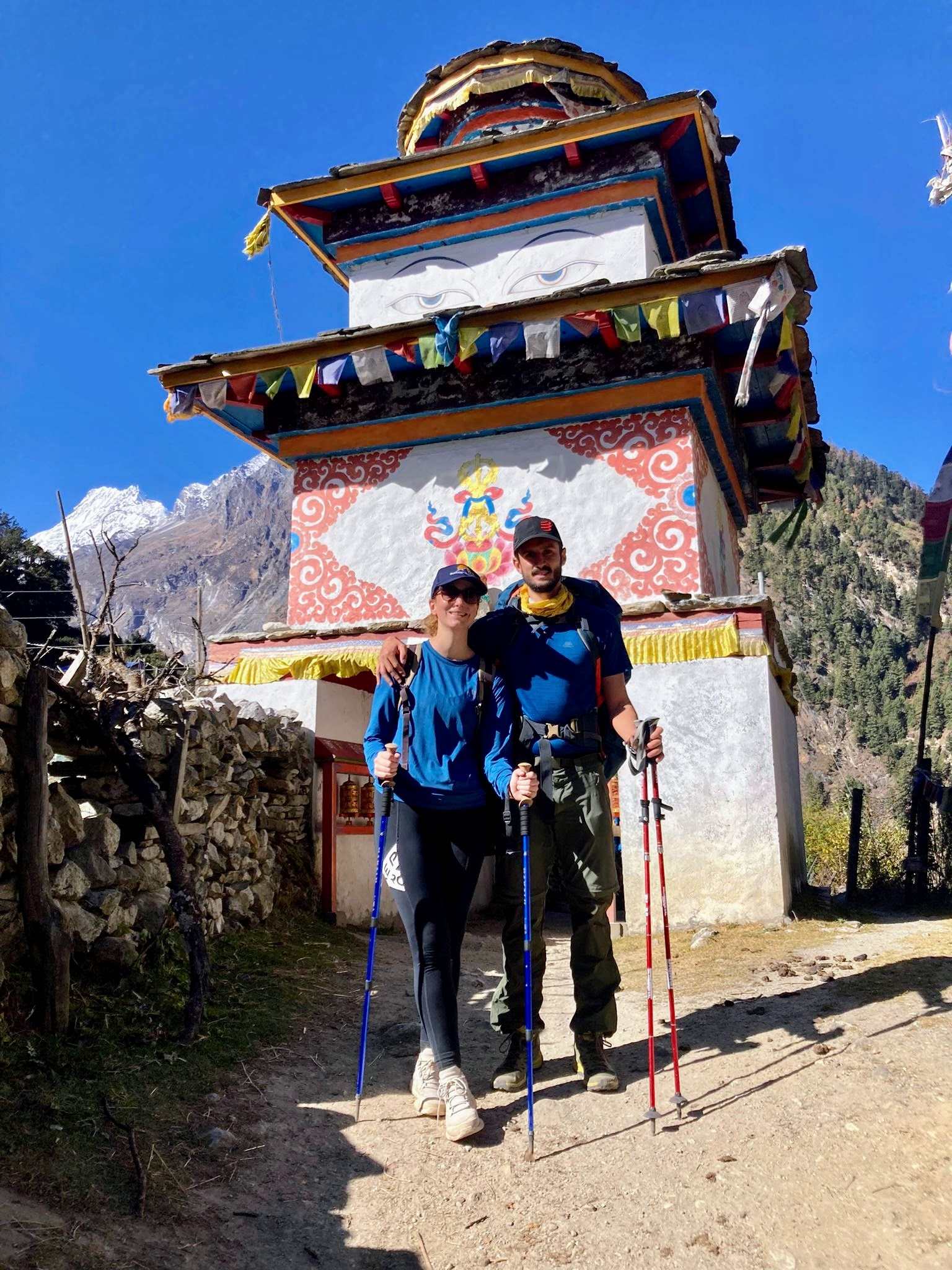
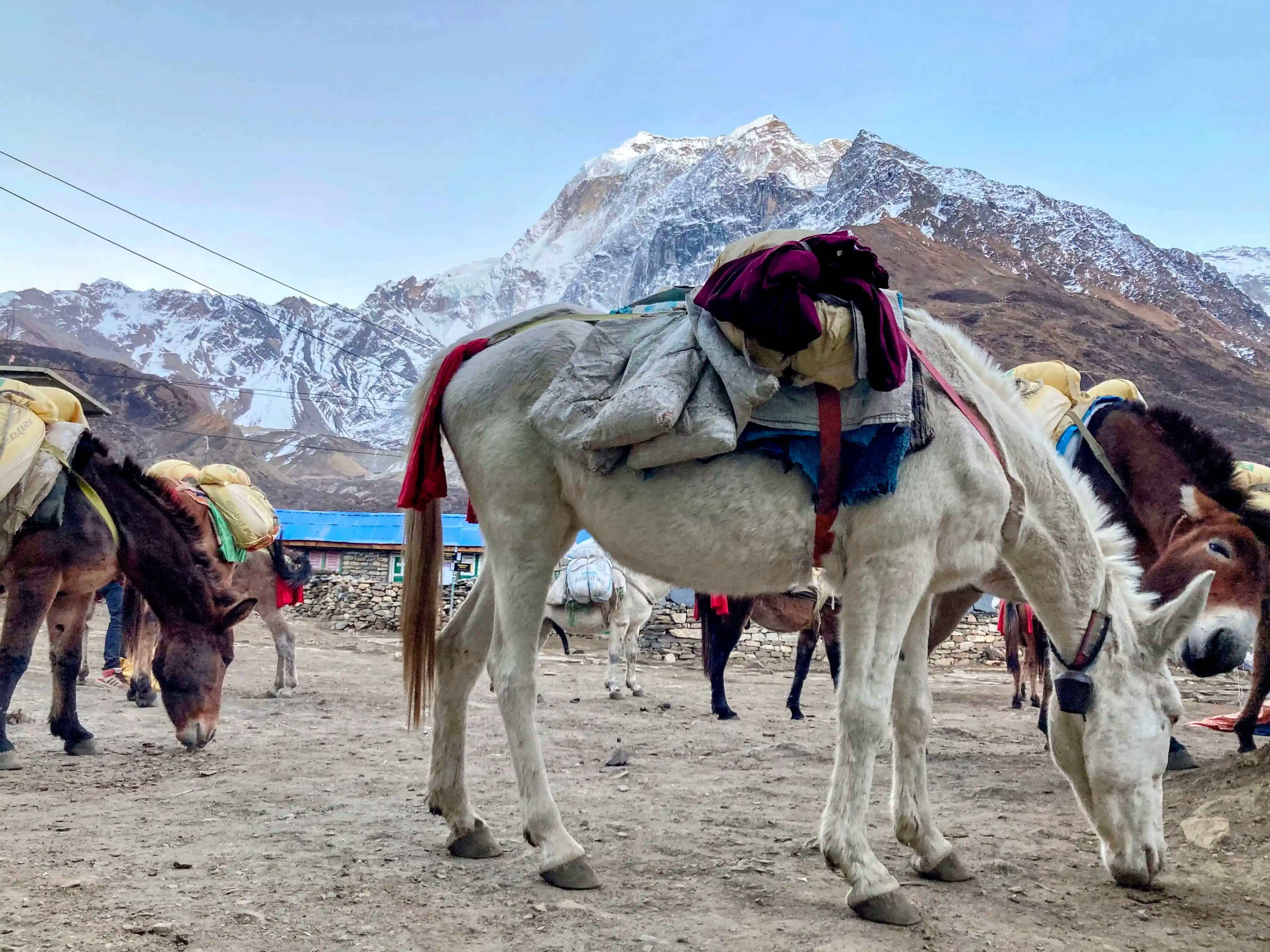
Deng is one of the last Hinduist places in the valley. From here on you will encounter a different ethnic group: Tibetan-Nepalese, with a different language (Tibetan), a different religion (Buddhist), and different habits and clothes. Here you can start to see mountain cows and maybe Yaks. Namrung is quite a small village, with some tea houses and even 2 small shops. Today the landscape starts changing from subtropical and lush to alpine.
Day 5: Trekking from Namrung to Samagaeon
Many people break this long route stopping one night either in Lho or Shyala. We started slightly feeling the altitude here with the air getting thin so we had a very relaxed pace. Nights also start getting colder and colder. Just leaving Namrung we can see again some farmers working on the rice harvest. The route is very diverse and scenic passing through forests with Rhododendron and firs but also through open landscapes.
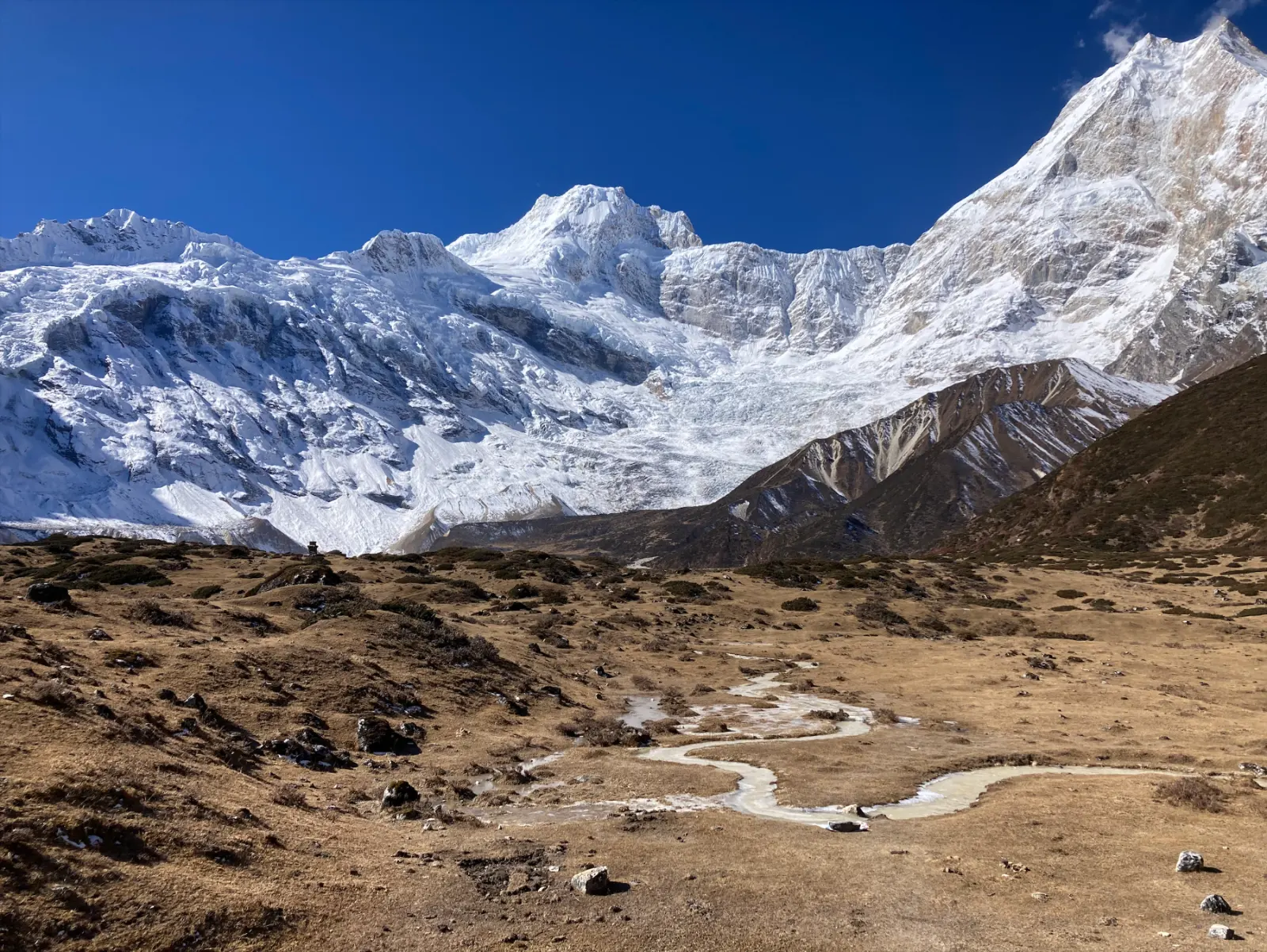
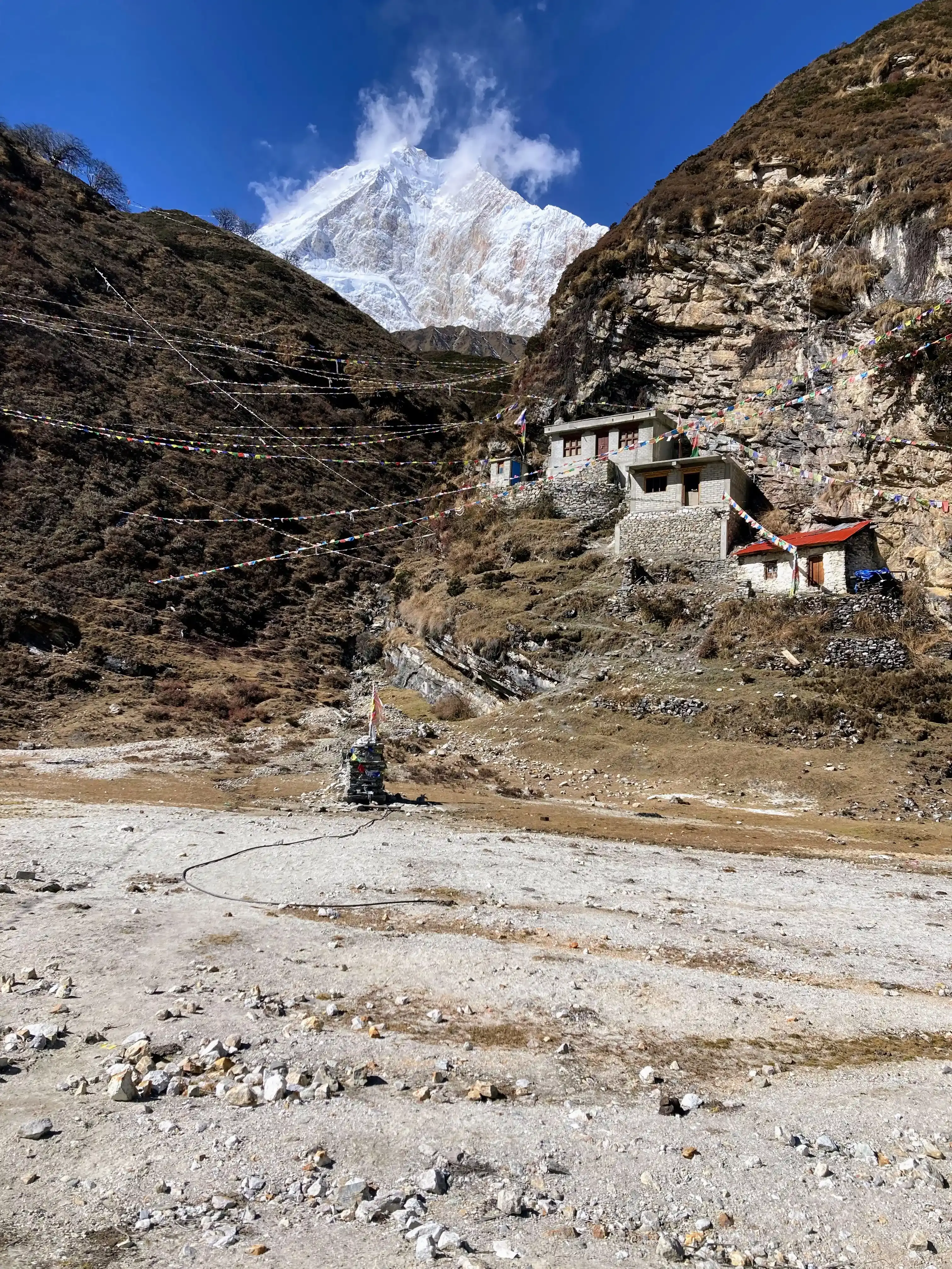
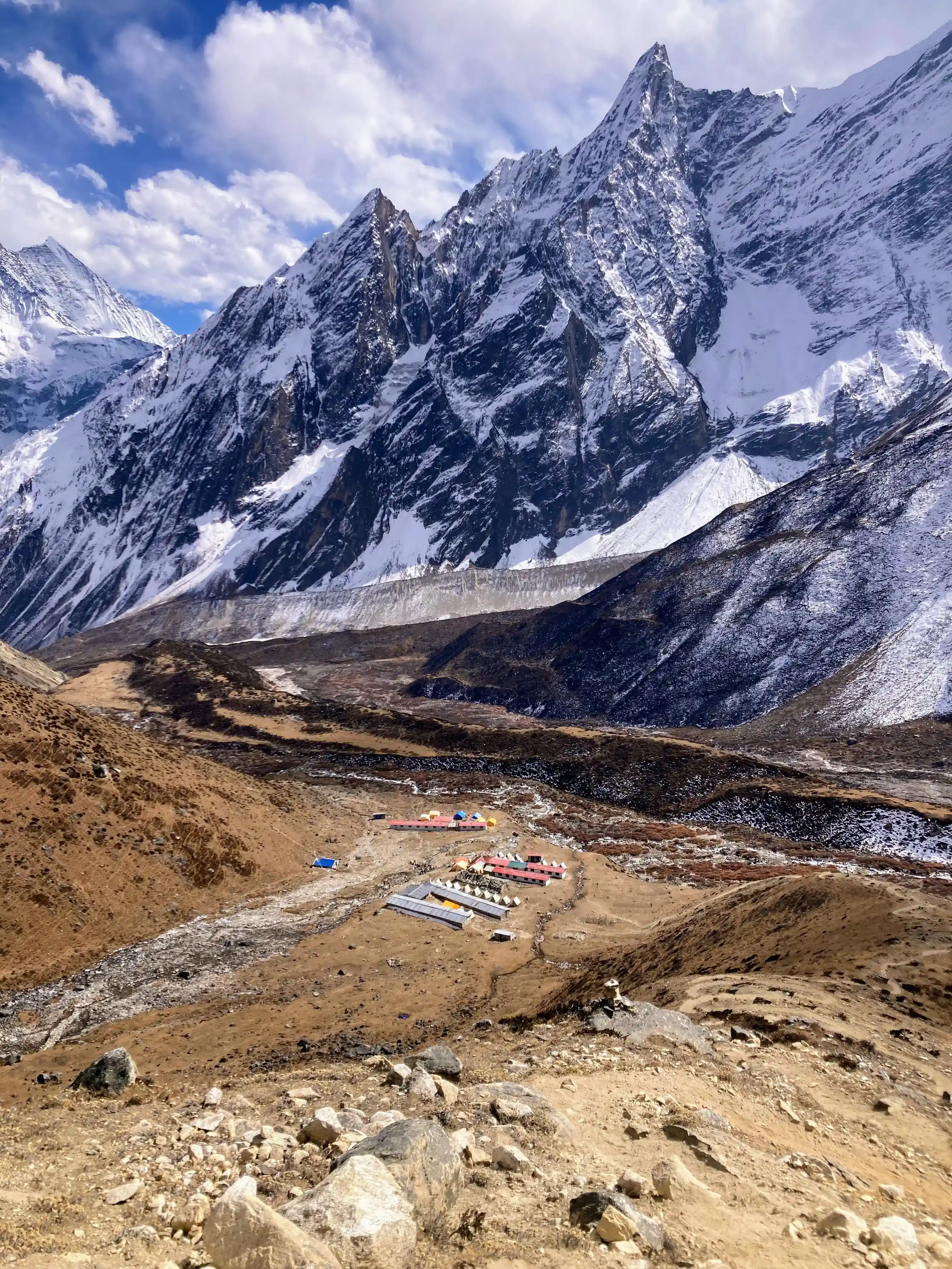
It is the first day on which you can see the Manaslu mountain. Samagaon is a bigger village with many houses, a monastery, and even one small shop. It was such an emotion for us to arrive in Samagaeon even though it was quite a late afternoon and it was already in the shadows. We were cold and tired after the longest walking day so far, however walking through the village to reach our tea house was surreal and touching. It felt to be back in the time of about 200 years: a dirty road passing through houses made of stones, wood, and yak dung. People's faces were stretched and hardened from years of living in the cold, yet smiling at every trekker passing by. The only signs of the 21st century were some small solar panels and some jackets or shoes.
In the evening we play cards with many other people close to the fire: scala quaranta (Italian card game) is the new trendy game in Nepal.
During the evening I get lucky enough to buy some Yak cheese. I am a true cheese lover and while hiking up, I asked several times to our guide Amar if there was the opportunity to taste some Yak cheese. While playing cards before dinner, Amar called me and told me to follow him and the tea house owner, because he knows where to buy. We venture in the dark and after a 5-minutes walk we get into an old stone and wooden house with an elevated entrance on the second floor. We climb the ladder and get inside a small smoky room. There is a stove in the middle as in all the traditional houses in this area, with 4 Nepali men sitting around it and - to my surprise - a French woman, chatting and enjoying a warm drink. She explained to me she is part of a small NGO - Tergar Charity Nepal - and she is experimenting with how to make cheese from Yak milk. The goal of the project is to preserve yak on one side and the other and provide the locals with a new source of income by selling cheese to the trekkers. They have not started to sell yet, so I am a beta tester of the product. I taste some good cheese and decide to buy a piece, even happier than before since I could contribute to a good cause.
Day 6: Acclimatisation in Samagaun - day trip to the Pungyen Gompa
Today is a “rest day” meaning that we stay in the same place for 2 nights. Amar, our guide recommends we visit the Pungyen Gompa (monastery) at 4000m. It is quite nice to walk for the first time without a heavy backpack. After some km, we reach the top and a huge valley opens up in front of us. We are breathless and we are not sure whether it is the altitude or rather the stunning landscape, with the Manaslu towering on the other peaks. It feels so close yet so far from us. Sofia said “This is the most beautiful landscape I have ever seen” and it is hard to disagree with that sentence. At the end of the valley, there is the monastery. It looks peaceful and remote, but unfortunately, it is already closed in November (monks leave during the winter).
From Samagaun it is also possible to reach the Manaslu base camp, however, we decided not to go given that it was too late in the season and nobody was there.
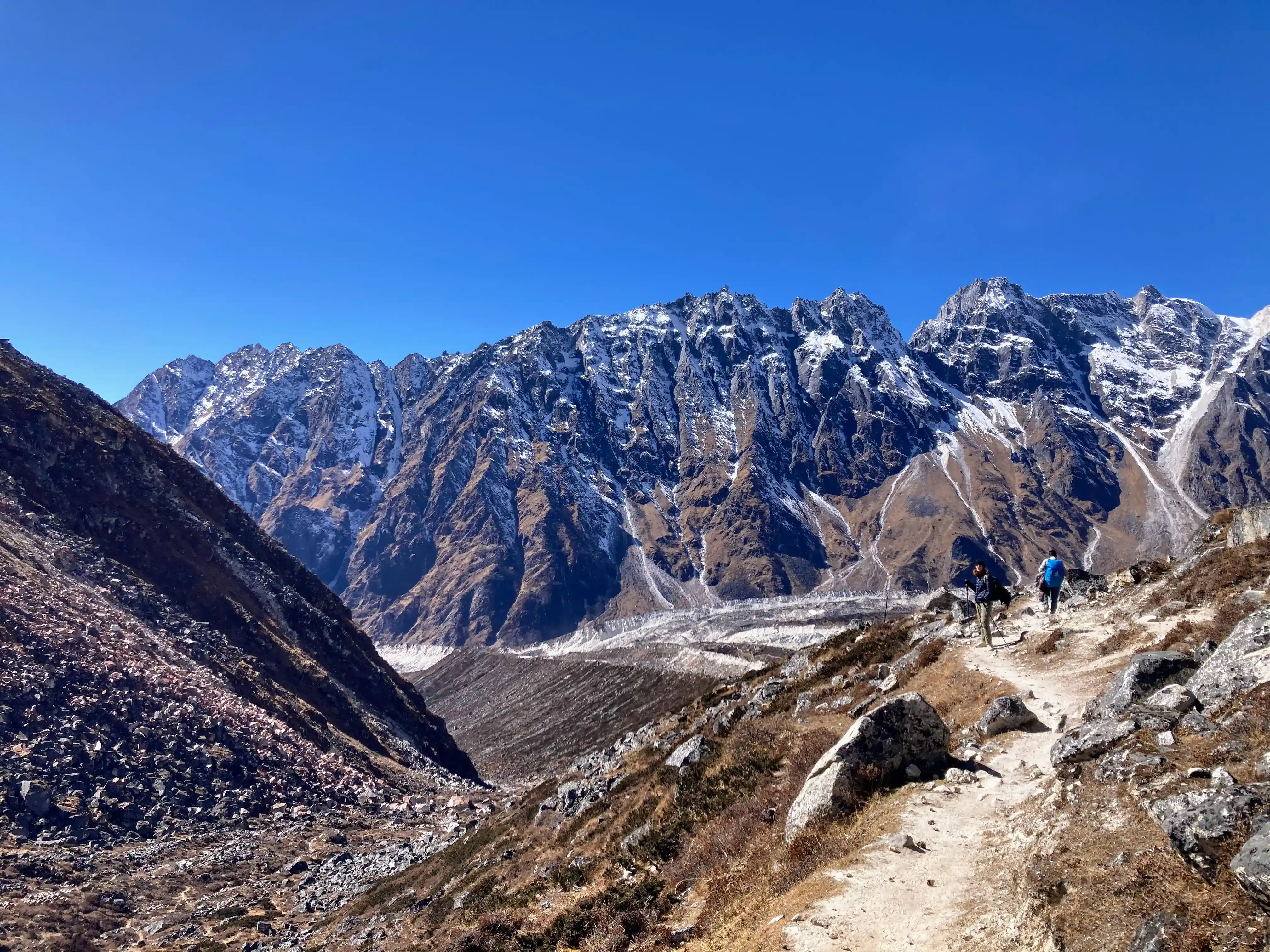
Day 7: Trekking from Samagaeon to Samdo
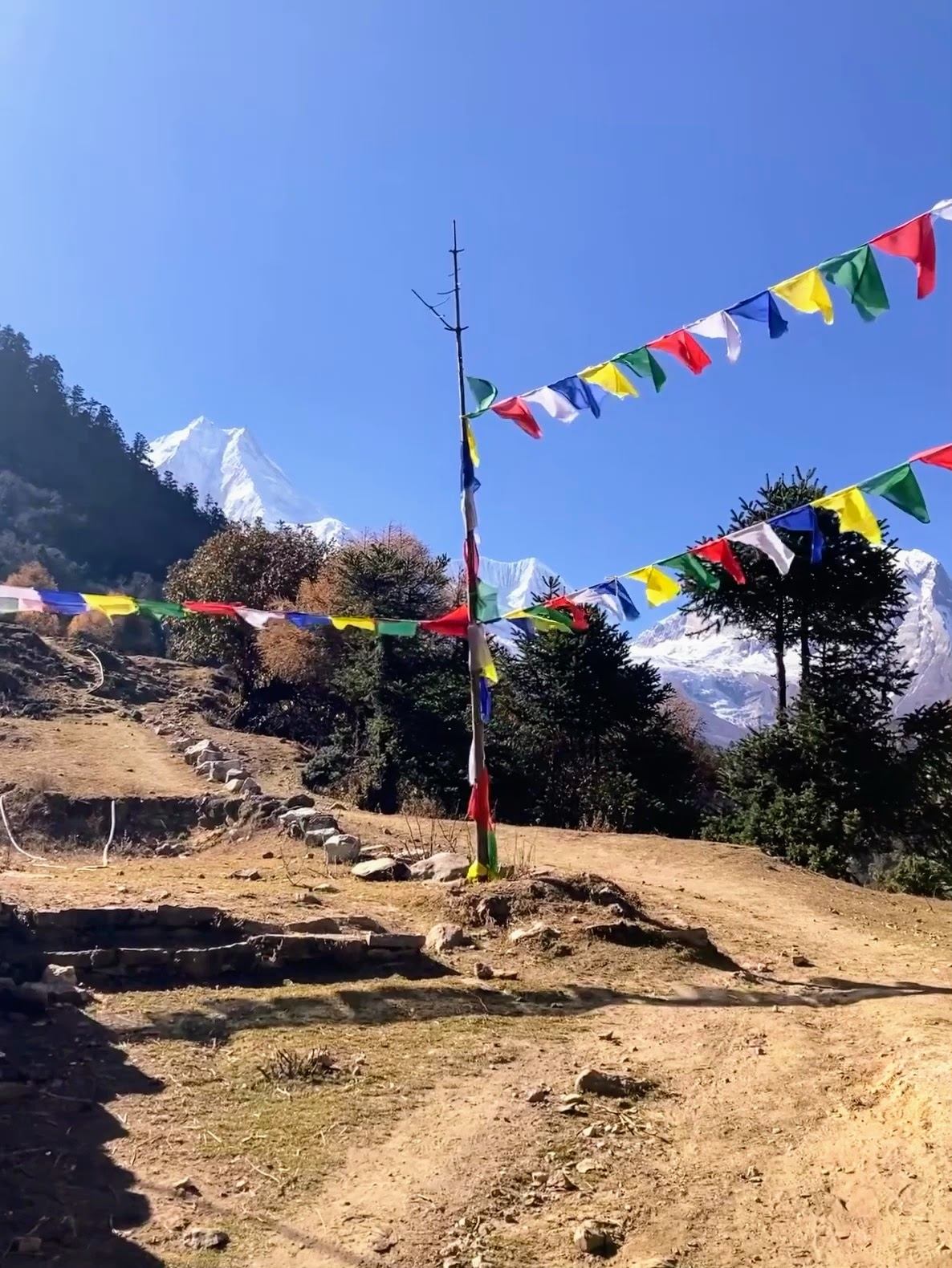
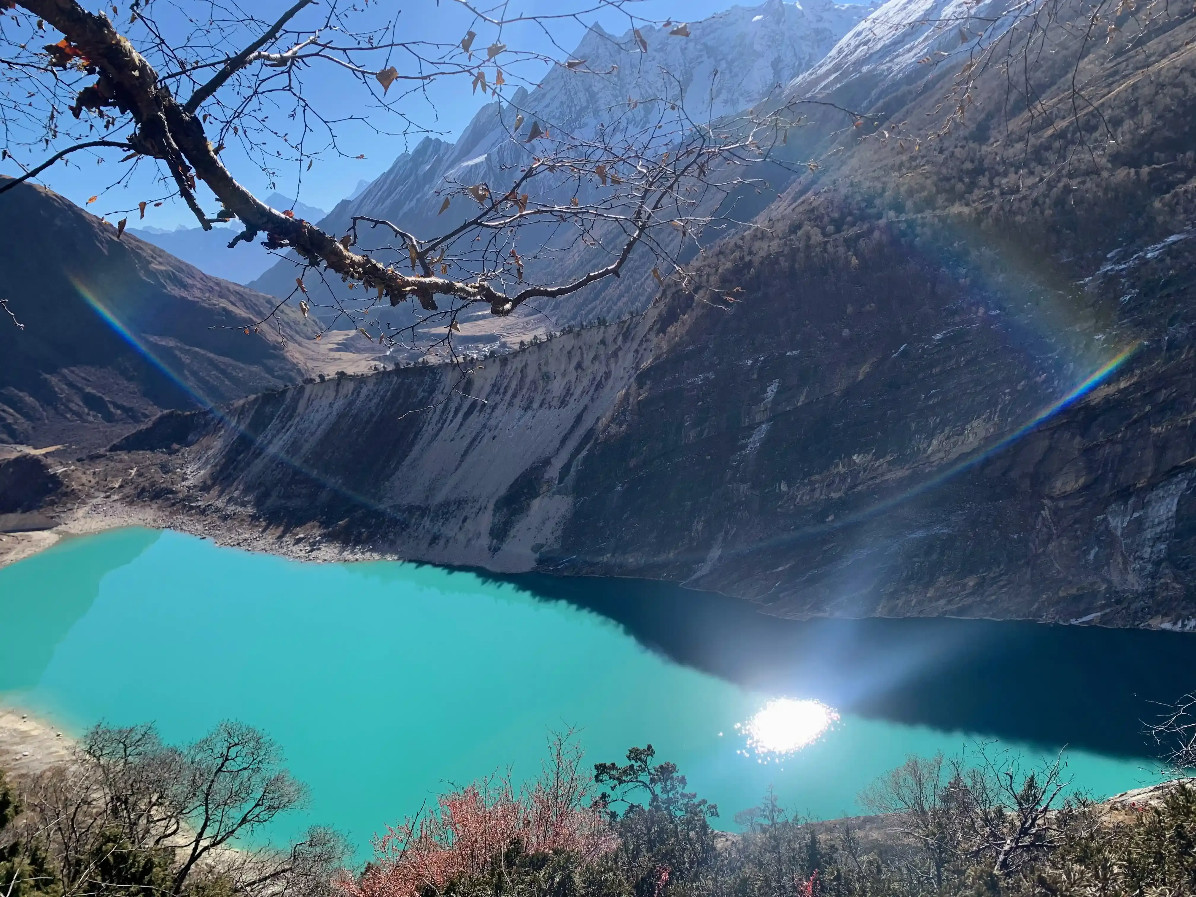
The trail today was quite easy and “flattish” with not much elevation to make. We made a small deviation to admire the beautiful turquoise Birendra Tal, an alpine lake on the way to the Manaslu Base Camp. We took some great pics here. On the way to Samdo, we passed through a big Mani wall and other Buddhist artifacts. We are blessed with such a wonderful sunny day. It does not take long to reach Samdo, and we arrive just in time for lunch, having enough time in the afternoon to rest and explore the area. We have the luck to see the monastery and hear a monk praying while the sun sets down, which is a truly unique experience.
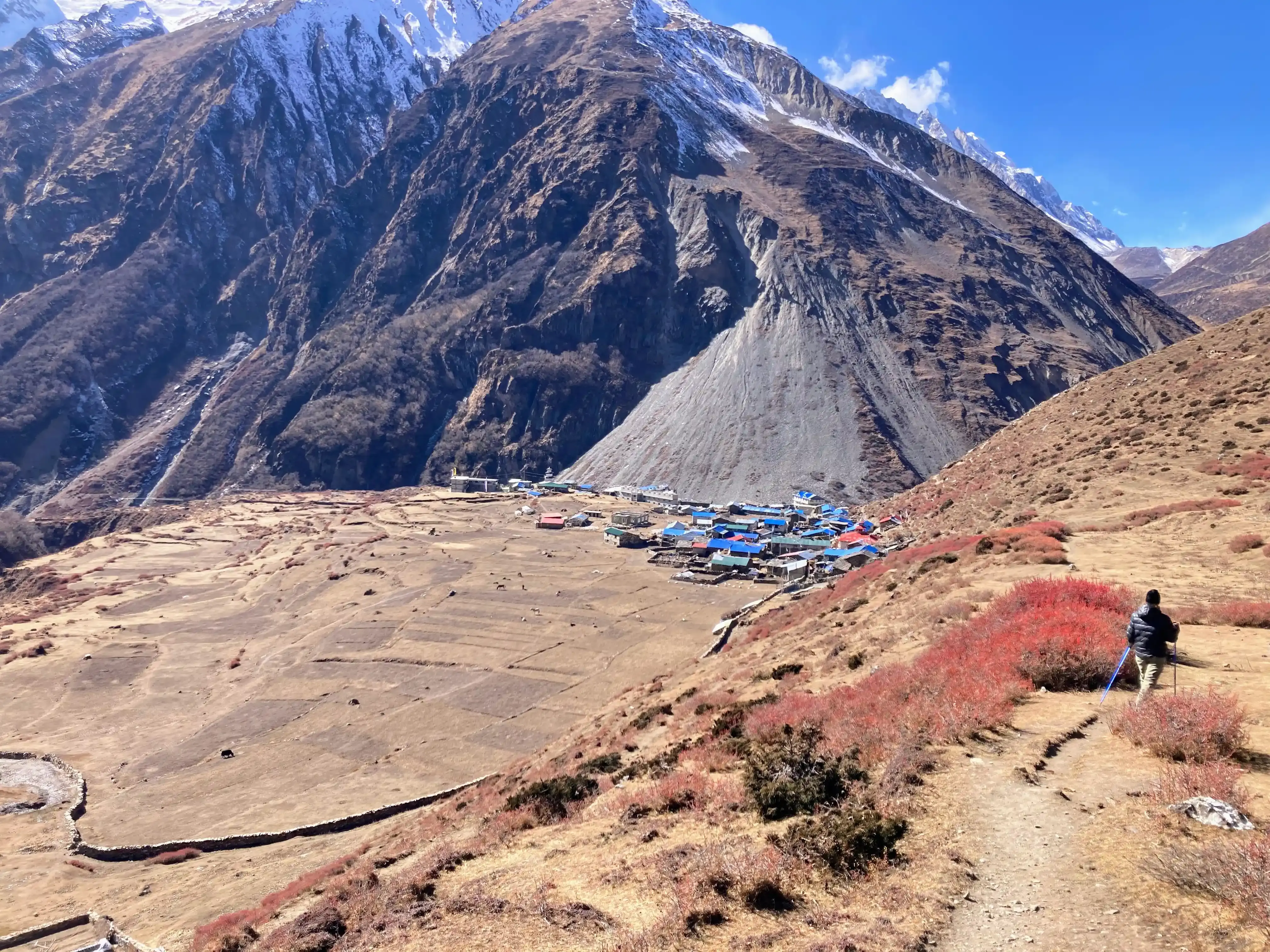
Samdo is the highest Tibetan setting in Nepal and is pretty remarkably perched on the cliffside.
Day 8: Acclimatisation day
Samdo and Samagaon are very very cold at night.
Since we did a pretty long trek in the first days, we had the luck of having one extra day in the trek. We decided to stay one more day in Samdo to acclimatize. Today we hike up around Samdo, reaching an altitude of 4800m. We can always see Samdo down in the small plateau and we are back for lunch. In the afternoon we chill and explore the surroundings.
During the evenings we stay pretty close to each other around the fire, reading or playing cards with the others.
Day 9: Trekking from Samdo to Dharmasala
The trekking route is pretty easy today, however, given the altitude you might experience a bit of altitude sickness. Sofia did not have any symptoms, while I had some headaches from time to time.
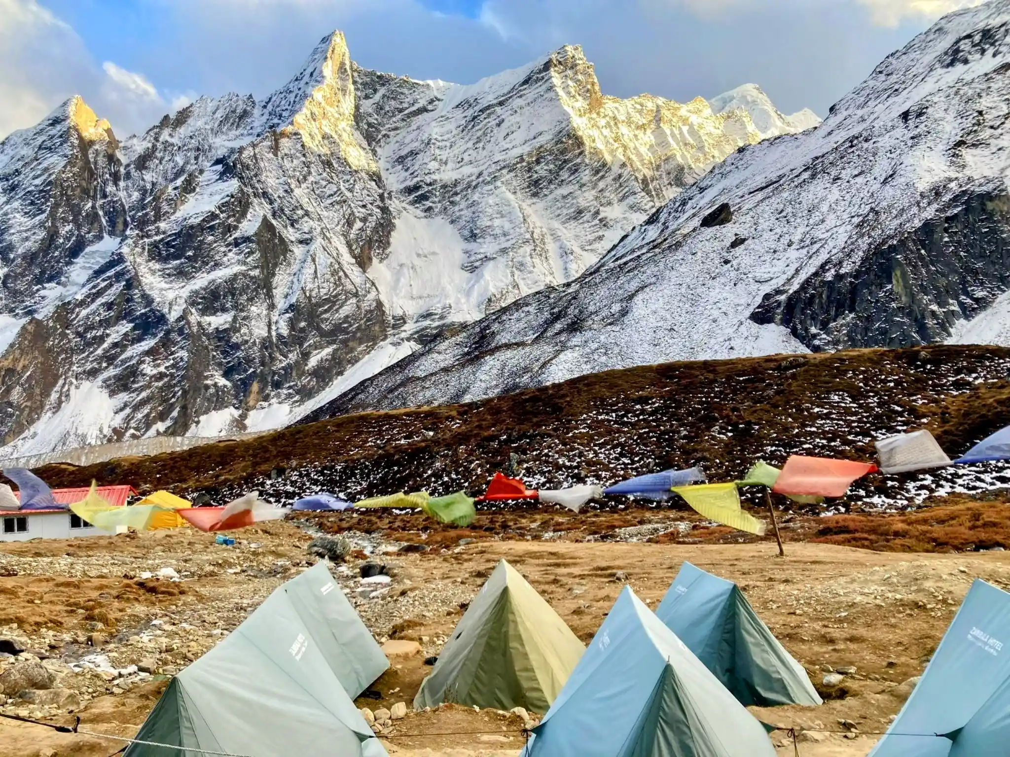
Dharmasala is just a bunch of tents and containers with only 2 kitchens. It is freezing outside and there is no campfire (given that there is no teahouse). The weather doesn’t look too good, with many clouds and strong wind, so we are all a bit worried it might be snowing or very windy tomorrow when we climb up the pass. We are anyway extremely excited and although the food here is very plain, the thrill for the day to come keeps up our morale.
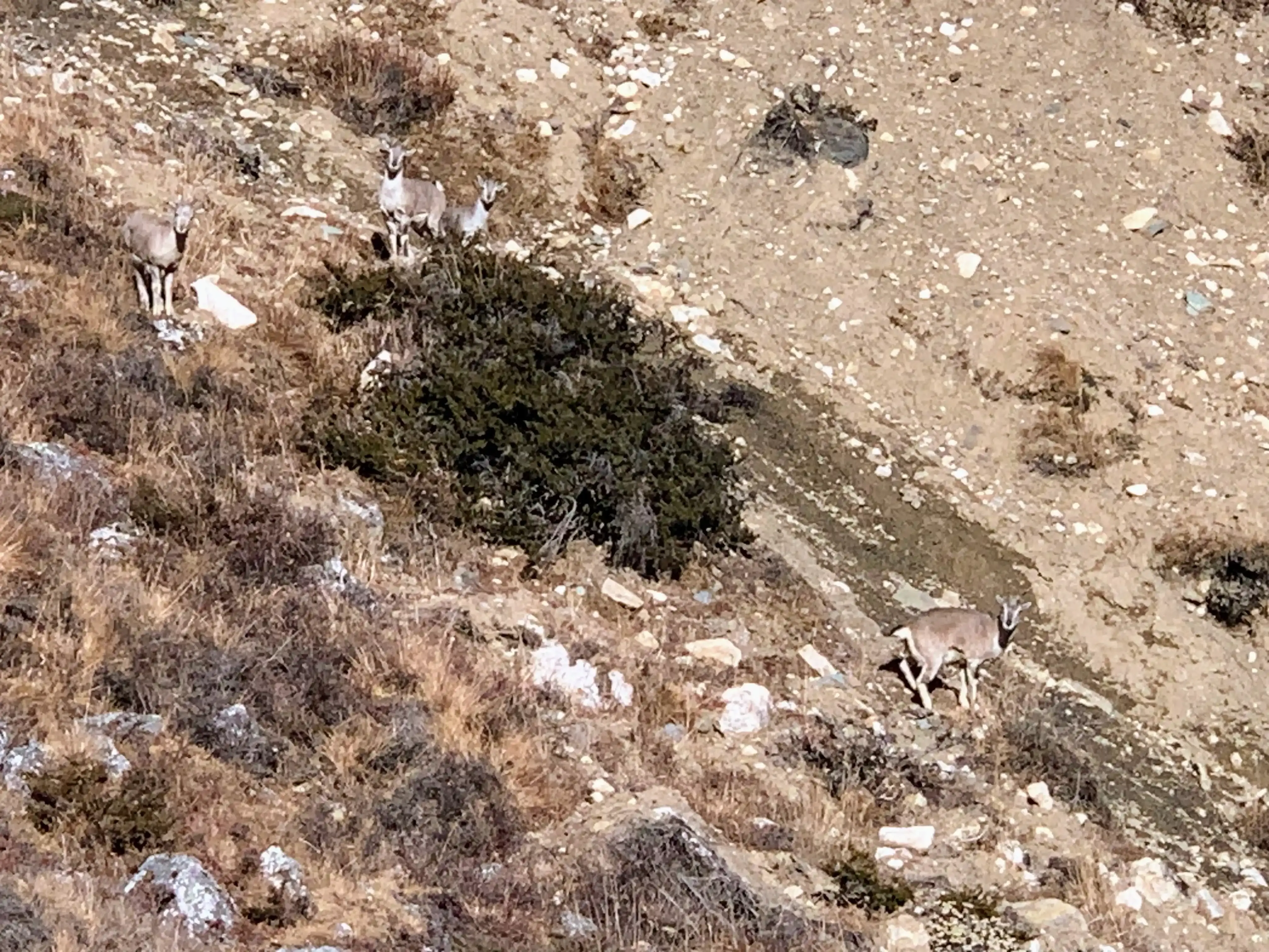
We have the luck of spotting many blue sheep along the way and close to the camp.
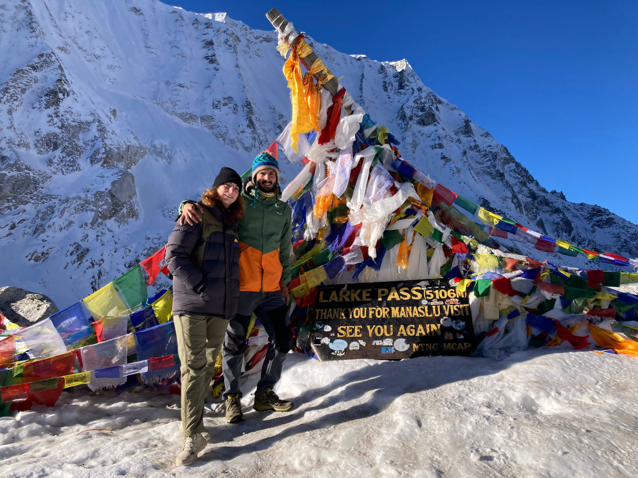
Day 10: Larke Pass day. Trekking from Dharmasala to Bhimtang
Today is the big day. After a not-so-good sleep, we wake up at 3 am and try to have some breakfast. Given the clouds of the day before, our guide has decided to start even a bit earlier. We start after breakfast and we hike the 2 most difficult hours of the whole trek. It is freezing outside, pitch-black, and we have an elevation of 800m to conquer. The sun gets out when we are ~1 hour away from the pass, making the walk easier.
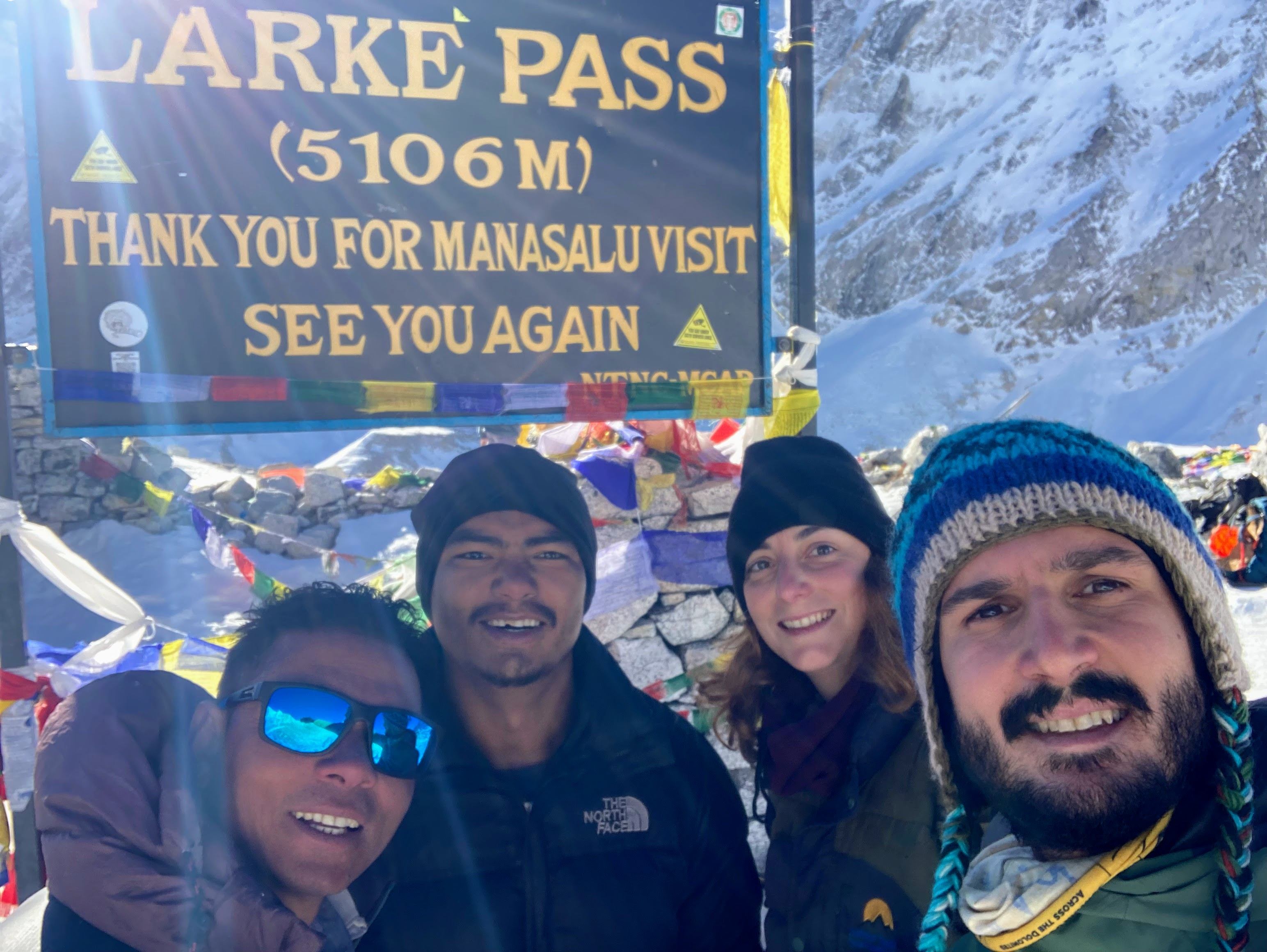
When we finally reach the top it is a burst of emotion: we finally made it! It’s beautiful up there and we are proud of ourselves, we made it!
On the way down we wear spikes for a small section before reaching a small tea-house for refreshments. The tuna pasta at 10 o’clock and a headache pill gives us the energy to finish the day.
Day 11: Trekking from Bhimtang to Gowa
The descent is fast and the landscape changes very fast. We leave behind the high-elevation vegetation and get through a beautiful Rhododendron forest. We are surrounded by huge trees and we overlook the north face of Manaslu, sharper and darker than the other side. We are pretty tired but still uplifted by the Pass conquest of yesterday. We arrived in Gowa, in what is by far the best tea house of the trek. We have our first hot-water shower after more than a week and also get connected to the outside world through the WiFi, after a silence of 6 days.
Day 12: Trekking from Gowa to Tilche and jeep to Besisahar
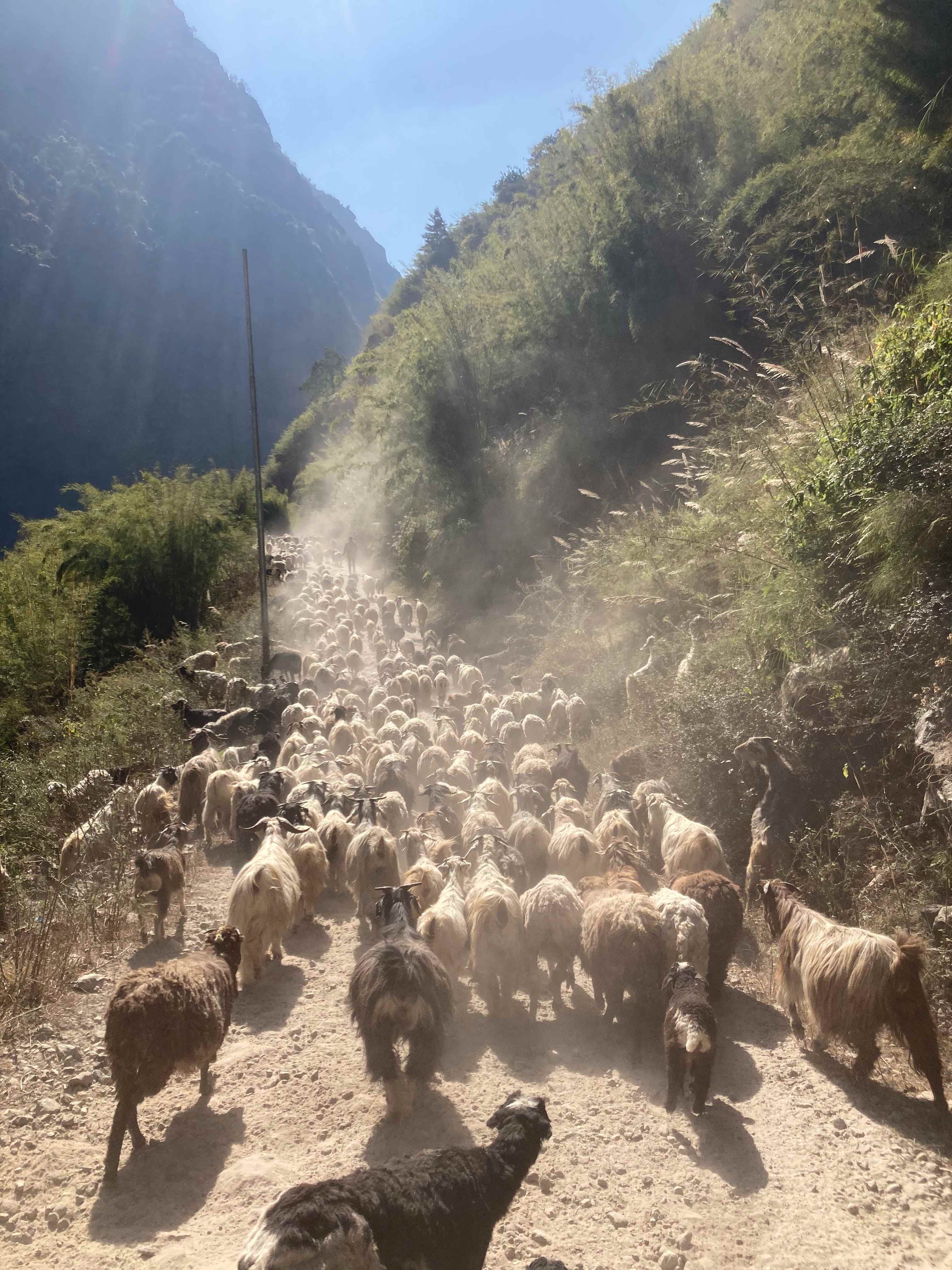
We walk the last km of the trek and take a shared jeep in Tilche. Before taking the Jeep, Sofia gifts her trekking poles to an old woman making her happy and smiley. After a long but scenic drive (interrupted here and there by massive flocks of sheep) we arrive in Besisahar for our last night together with Amar and Bishal. We are happy about the accomplishment but sad that we are parting ways. After almost 2 weeks of long walks, card games, and nice chats, we feel we are leaving behind some friends rather than just a guide and a porter. We are sure we will meet them again. Some last drinks and laughs are shared on our final night.
Day 13: Bus ride from Besisahar to Pokhara
After our farewell to Amar and Bishal, we take the bus to Pokhara leaving behind the mountains. The vegetation becomes greener the more you go down and there are more and more people on the side of the street.
After settling in Pokhara, we decide to celebrate with a well-deserved pizza.